Vermont Transportation and physical map large printable

Vermont Transportation and physical map large printable is the Map of Vermont. You can also free download Map images HD Wallpapers for use desktop and laptop. Click Printable Large Map
Location: Northeastern United States
Capital: Montpelier
Largest city: Burlington
Major cities:
St. Albans, Newport, Rutland
Neighboring states:
New York, Massachusetts, New Hampshire, Canada.
Geographic Features:
The Green Mountains, Taconic Mountains, Champlain Lowlands, Northeastern Highlands
Major river: Connecticut
Largest Lake: Lake Champlain
Highest Point: Mount Mansfield (1340m, 4393 ft)
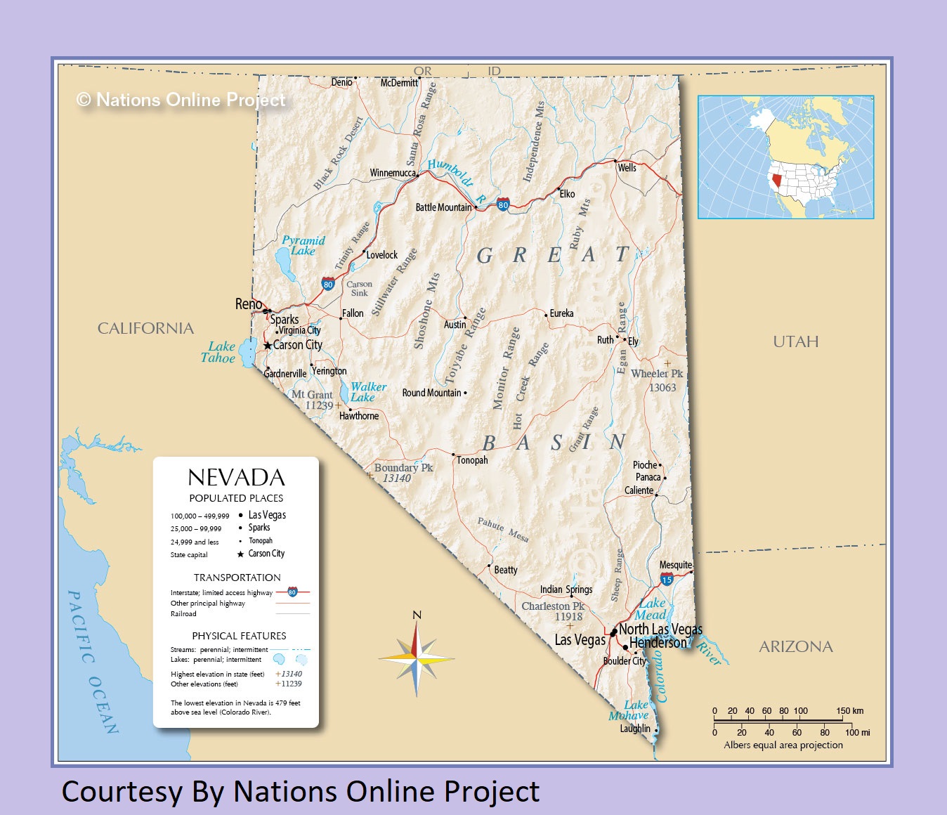
Nevada Transportation and physical map large printable
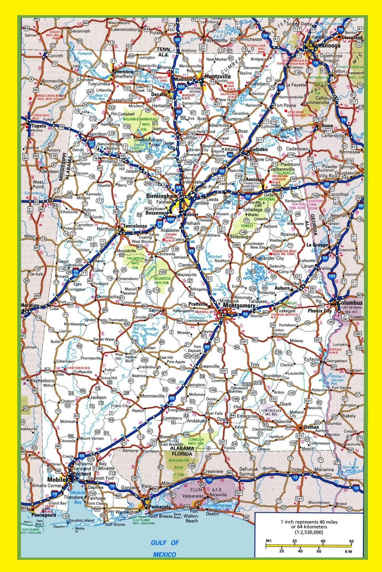
Alabama Large Highway Map Large Highway Map of Alabama-city-county-political
| « Utah Physical And Transportation Map | Large Printable Map | Virginia Transportation And Physical Map | Large Printable HD Map » | |


