Road Map Of Bangladesh | Bangladesh Transport Map

Bangladesh Road maps are a great help to find the way while traveling to different parts of the Country. Road Map Of Bangladesh provides greater insight into various road networks of the countries through maps. A well-developed infrastructure is the most important part of any country’s economy, and a road network is the most crucial part of it.
Bangladesh Transport Map shows all the major roads, freeways, and highways of the countries included in the listing. Apart from providing details of the road network, maps also highlight the major towns, airports, provincial boundaries, and international boundaries of these countries, portions of countries, or states.
Highways Of Bangladesh

The transportation system in Bangladesh is multimodal. Tourists can experience certain forms of transportation that are not available in the western world, such as ‘rickshaws’. Dhaka, the capital city of Bangladesh, is famous as the rickshaw capital of the world! Rickshaws are the traditional method of transportation in Bangladesh. It is very environment friendly because they don’t require any fuel. Tourists will find rickshaws the most inexpensive mode of transport in Bangladesh. Another version of the rickshaw that is found in Northern and Southwestern districts is known as ‘van’.
Road Network
The Roads and Highways Department (RHD) manage several categories of road. RHD has a total length of 20,948 Km road under its control. RHD also controls a total number of 4,659 bridges and 6,122 culverts. RHD is currently operating about 161 ferry boats in 81 crossings (13 on national highways, 11 on regional highways, and 57 on feeder roads) on its road network throughout the country. As of January 2010, the Local Government Engineering Department (LGED) has so far constructed a total of 133,514 km (64,691 km dirt road and 68,823 km paved roads) Upazila and union roads and 971,498 bridges/culverts.
Road Map Of Bangladesh | Bangladesh Transport Map is the Map of Bangladesh . You can also free download Map images HD Wallpapers for use desktop and laptop.
Road Map
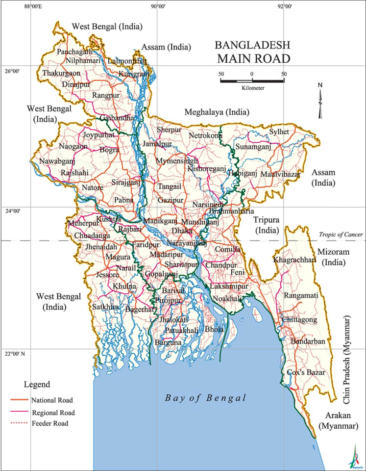
Road transport in Bangladesh is a private sector affair operating predominantly in domestic routes. Rates are among the cheapest in the world. Express and non stop services are available to principal towns from Gabtoli, Saidabad and Mohakhali bus terminals in Dhaka.
Railway Map
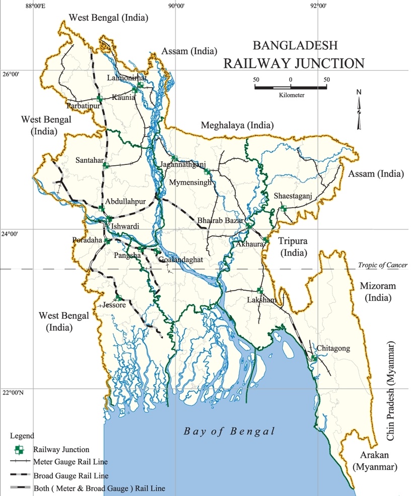
The Bangladesh Railway provides an efficient service to places of interest such as Chattogram, Sylhet, Khulna, Mymensingh, Bogra, Rajshahi, Dinajpur starting from Dhaka. The inter-city Express Service is available to and from important cities at cheap fares.
Waterways
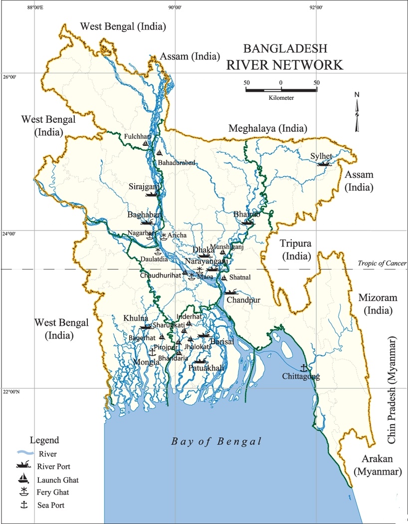
Country-Made boats are the most widely used carrier one can see in the river and rivulets. These carry passengers and merchandise on a large scale. The landscape of Bangladesh is dominated by about 250 rivers which flow essentially north-south.